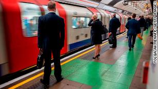
伦敦正在追踪地铁上的乘客
London's subway has become the latest transportation agency to use location data collected from people's smartphones in a bid to improve services.
伦敦地铁已经成为最新一个利用从人们的智能手机收集的位置数据来改善服务的交通机构。
Transport for London, which operates the Tube, began collecting data in its stations this week, in order to determine how people are moving through the system and how crowded trains and platforms are. It said passengers will benefit as they will get more alerts about delays and congestion later this year. Extra trains could also be added on routes where the data indicates trains are especially congested.
运营地铁的伦敦交通局本周开始在其车站收集数据,以确定人们在地铁系统中的出行情况以及列车和站台的拥挤程度。它说,乘客将从中受益,因为他们将在今年晚些时候收到更多关于延误和拥堵的警报。在数据显示列车特别拥挤的线路上也可以增加额外的列车。
It's become increasingly common in recent years for transportation organizations worldwide to use smartphone data to better plan services. They say digital data offers services that greatly surpass previous methods, such as user surveys.
近年来,世界各地的交通组织越来越普遍地使用智能手机数据来更好地规划服务。他们说,数字数据提供的服务大大超过了以前的方法,如用户调查。
But transportation experts believe London may have the first public transportation system to track and use individual trip data in real time. Given how large a system London operates, other cities may follow suit if the project succeeds. The practice also raises concerns about user privacy, unwanted tracking, potential hacks and the misuse of data.
但交通专家认为,伦敦可能拥有首个能够实时跟踪和使用个人出行数据的公共交通系统。考虑到伦敦运营的系统规模之大,如果该项目成功,其他城市可能会效仿。这种做法还引发了人们对用户隐私、不必要的跟踪、潜在黑客攻击和数据滥用的担忧。
In London, there is no process to obtain consent from passengers for the data collection aside from signs posted in stations, explaining that data is being collected to improve services. The signs also say people can opt out by turning off their wifi.
在伦敦,除了在车站张贴的说明数据收集是为了改善服务的标志外,没有获得乘客同意的程序。这些标志还表示,人们可以通过关闭wifi选择退出。
Smartphones aren't the only way transportation agencies collect location data. In 2018, the Los Angeles Department of Transportation released a way for cities to track shared e-scooter and e-bike rides, by requiring the vehicles to broadcast their location to the local government.
智能手机并不是运输机构收集位置数据的唯一方式。2018年,洛杉矶运输部发布了一种方法,让各城市追踪共享电动摩托车和电动自行车使用情况,要求这些车辆向当地政府公布其位置。
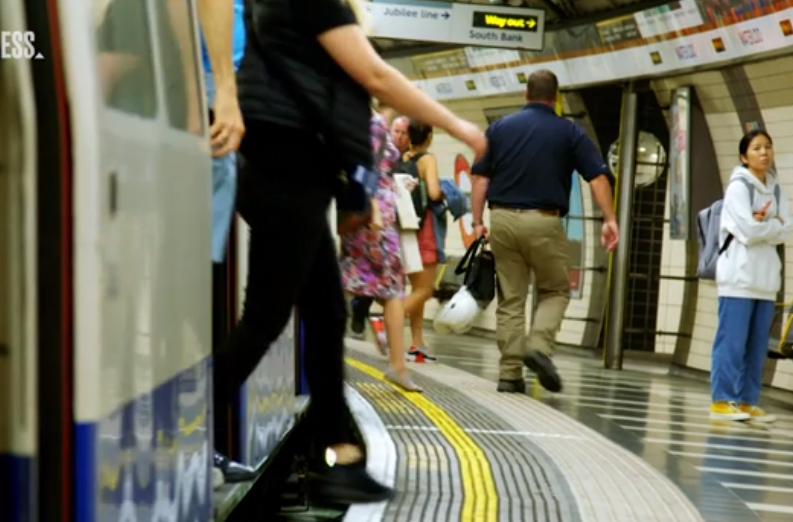
London's program relies on wifi in 260 of its stations to understand where people are, such as waiting on the platform or in a ticketing area. It can get the location of any smartphone in the area that has its wifi turned on. Phones do not need to be connected to the subway's wifi network.
伦敦的这一项目依靠260个车站的wifi来了解人们在哪里,比如在站台或售票等候区。它可以获取该地区任何一部智能手机的位置,只要它的wifi是打开的。手机不需要连接到地铁的wifi网络。
Transport for London says it will be able to monitor in real-time how long it takes people to walk from the ticketing area to the train platform, and estimate how many people are on each train. The program is an expansion of a 2016 pilot that it deemed a success.
伦敦交通局表示,他们将能够实时监控人们从售票区步行到站台需要多长时间,并估计每辆火车上有多少人。该项目是2016年成功试点项目的扩展项目。
Agencies such as Transport for London use anonymous location data as a security measure, according to the agency. But reidentifying — the practice of linking anonymous data to a person — has also been shown to become easier when combined with other databases, according to experts.
据该机构称,伦敦交通局等机构使用匿名位置数据作为安全措施。但据专家称,与其他数据库结合后,重新识别(将匿名数据与个人联系起来)也变得更容易。
London said it isn't linking the anonymous data to other customer information, and only individual, depersonalized data is available to a controlled group of employees. Only aggregated data may be shared with other Transport for London departments, and external bodies.
伦敦交通局说,它没有将匿名数据与其他客户信息联系起来,只有一组受控制的员工可以获得非个性化的个人数据。只有汇总数据才能与伦敦其他交通部门和外部机构共享。
Data can be shared with law enforcement if police demonstrate through a formal process that the data release is justified to prevent or detect crime or prosecute an offender, according to Transport for London.
根据伦敦交通局的说法,如果警方通过正式程序证明数据发布是合理的,可以防止或侦查犯罪或起诉罪犯,数据就可以与执法部门共享。
Collecting data via wifi isn't the only option for transportation agencies. StreetLight Data, a San Francisco-based company, supplies location data to dozens of cities, states and agencies, illuminating how cars, trucks, pedestrians and bikes move on streets. It uses location data from smartphone apps and connected cars that it buys from data collection companies such as Cuebiq, and says it has data on about a quarter of all trips through a given area.
通过wifi收集数据并不是运输机构的唯一选择。总部位于旧金山的StreetLight数据公司向数十个城市、州和机构提供位置数据,阐明汽车、卡车、行人和自行车如何在街道上移动。它使用来自智能手机应用程序和从Cuebiq等数据收集公司购买的联网汽车的位置数据。该公司表示,它拥有某一特定区域约四分之一的行程数据。
Some areas, such as the transportation authority in Flagstaff, Arizona, say the data from StreetLight has helped them better plan services and save taxpayer dollars.
一些地区,如亚利桑那州弗拉格斯塔夫市的交通管理局表示,StreetLight数据公司帮助他们更好地规划服务,节省纳税人的钱。


